


Complete Survey Services
Matt Hull Consulting provides a full range of survey services designed to meet your project's unique needs. From 3D laser scanning, measured building surveys, and topographical surveys to aerial surveying, mapping, and inspections, we offer precise and detailed data collection that enhances project accuracy and efficiency. Our team is equipped with advanced technology to deliver comprehensive survey results tailored to your specific requirements, helping you make well-informed decisions every time.
Advanced Technology & Software
At Matt Hull Consulting, we employ the latest 3D laser scanning, UAVs (drones), total stations, and GPS technology to capture highly accurate, high-resolution data. Our state-of-the-art equipment, supported by advanced software, enables us to deliver precise measurements and detailed mapping. From point cloud modelling to topographic surveys, our integrated technology ensures dependable results, allowing us to provide valuable insights that enhance the accuracy and efficiency of your projects.
Why Choose Matt Hull Consulting?
At Matt Hull Consulting, we are committed to delivering exceptional quality and service. Our extensive experience and state-of-the-art technology ensure that every project is managed precisely and carefully. We take the time to understand your needs, providing customised survey solutions that enhance project outcomes. Whether you require 3D laser scanning, aerial mapping, or GPS surveys, we pride ourselves on our reliability, accuracy, and excellent customer service. Choose us for expertise you can rely on and results you can trust.
Your Trusted Partner in Consulting
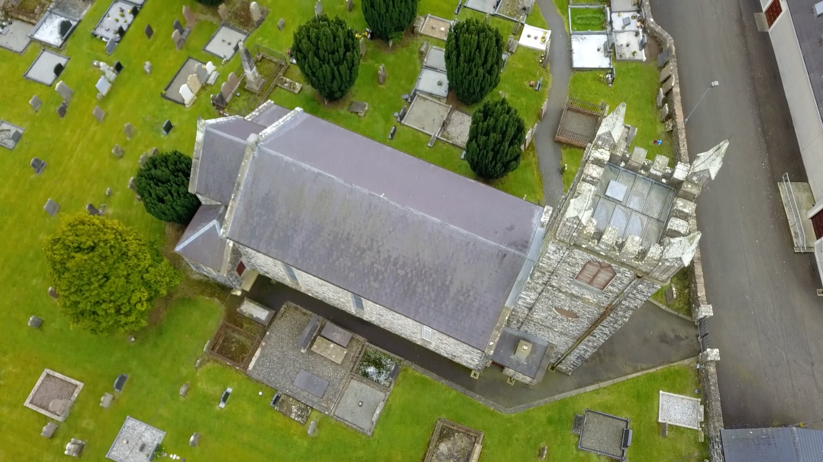
Photogrammetry Surveys
Our photogrammetry services utilise high-resolution imagery to produce accurate 3D models, maps, and measurements. By capturing multiple images from various angles, we create detailed visual representations of your site or structure, perfect for planning, analysis, and design applications. Our photogrammetry solutions provide precise, reliable data to support informed decision-making, whether for topographic mapping, volume calculations, or asset inspection.
Topographical Surveys
Our topographical survey services provide detailed and accurate site surveys, capturing natural and artificial features to create precise terrain models. By employing advanced equipment such as total stations, GPS, and UAVs, we map elevations, contours, and essential features, delivering reliable data for planning, design, and construction projects. Whether for development, infrastructure, or land assessment, our topographical surveys provide insights to help you make informed decisions and confidently advance projects.
Measured Surveys
Our measured survey services offer exact data for existing structures and environments. We obtain accurate measurements of buildings, landmarks, and more by utilizing 3D laser scanning, total stations, and other cutting-edge technologies. Whether you require detailed floor plans, elevations, or cross-sections, our measured surveys provide trustworthy results that assist in renovation, restoration, and design projects, guaranteeing that all existing conditions are meticulously documented.
Drone Surveys and Inspections
Our drone surveying and inspection services offer a speedy, cost-effective solution for capturing high-resolution aerial data. By utilising UAVs (drones), we collect detailed imagery and measurements for large-scale sites, inaccessible areas, and infrastructure. From land surveys to building inspections, our drone technology provides quick, precise results while minimising disruption to your project. Whether for site monitoring, structural assessments, or mapping, our drone services yield valuable insights and enhance your decision-making process.
CAD and Revit
Our CAD and Revit services deliver precise, high-quality digital models and drawings for your projects. We excel at producing accurate 2D and 3D plans, elevations, and as-built models that effortlessly fit into your design and construction workflows. By utilizing state-of-the-art software, we convert survey data into comprehensive CAD and Revit models, allowing you to visualize your project, enhance collaboration, and maintain accuracy throughout the design and construction phases.